Sign in

Waste collection software

Collect what's full,
not what's next.

NexusOptimo shows every bin, truck and route on one screen, plans tomorrow's rounds from sensor readings, and gives drivers a simple app to work through them.

80%full, and a bin is flagged critical on the dashboard and the map
7 daysof silence, and a bin goes back on the plan by itself
1 tapconfirms a collection in the driver app
2 waysto track a truck: a GPS tracker or the driver's phone

How it works

From a full bin to a finished round.

1

Bins report how full they are

Sensors send fill levels straight into the platform. Use DF703 4G sensors, or any sensor that can send MQTT or HTTP. Bins at 80% or more stand out at once, so nobody has to go looking.
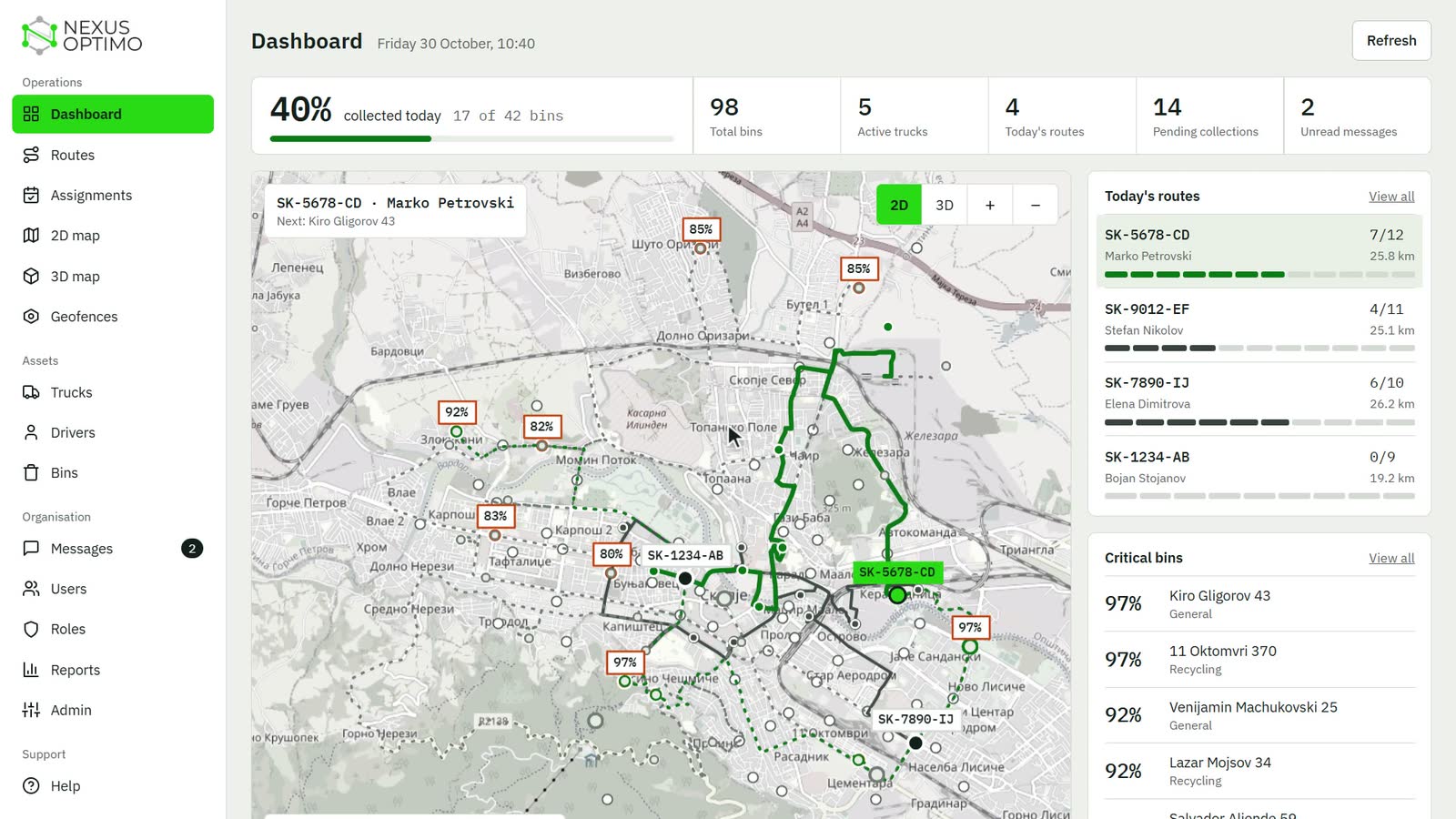
The NexusOptimo dashboard map, with critical bins labelled with their fill level
2

Tomorrow's routes are planned for you

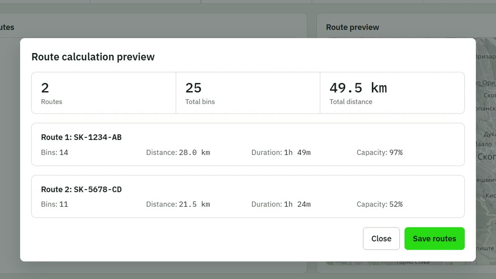
Every day the planner picks the bins that need collecting, fullest first, matches them to each truck's capacity, and works out the order of the stops. Dispatchers can also calculate a plan on demand, preview it, and save it.

A route plan preview, showing the stops and distance for each truck
3

Dispatch sees the day as it happens

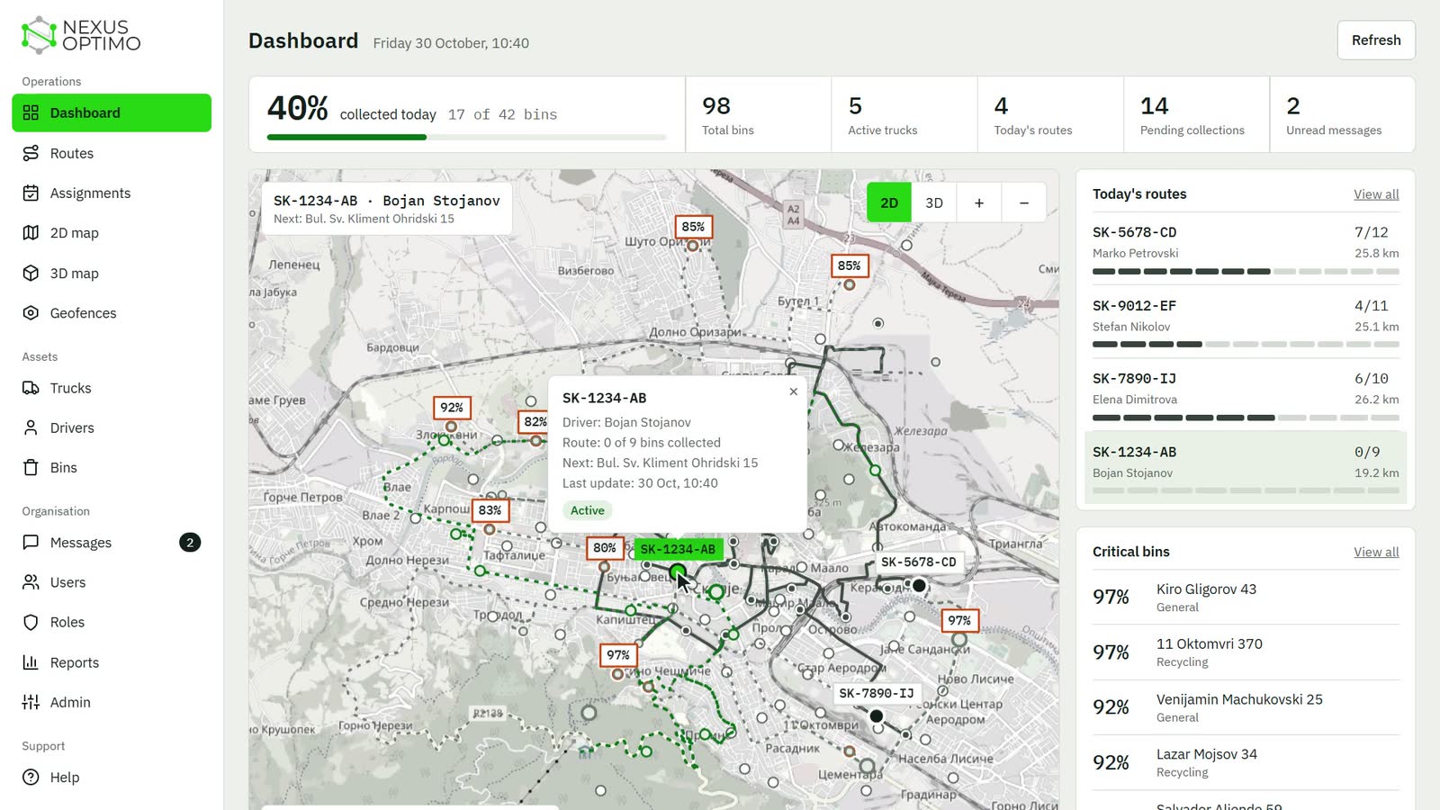
Today's routes, collection progress, critical bins and fleet status, all on one screen. Click any bin or truck on the map to see what it needs and who's on the way, and switch to 3D in the same view.

The dashboard with a truck selected, showing its driver, route progress and next stop

For drivers

Nothing to download from an app store.

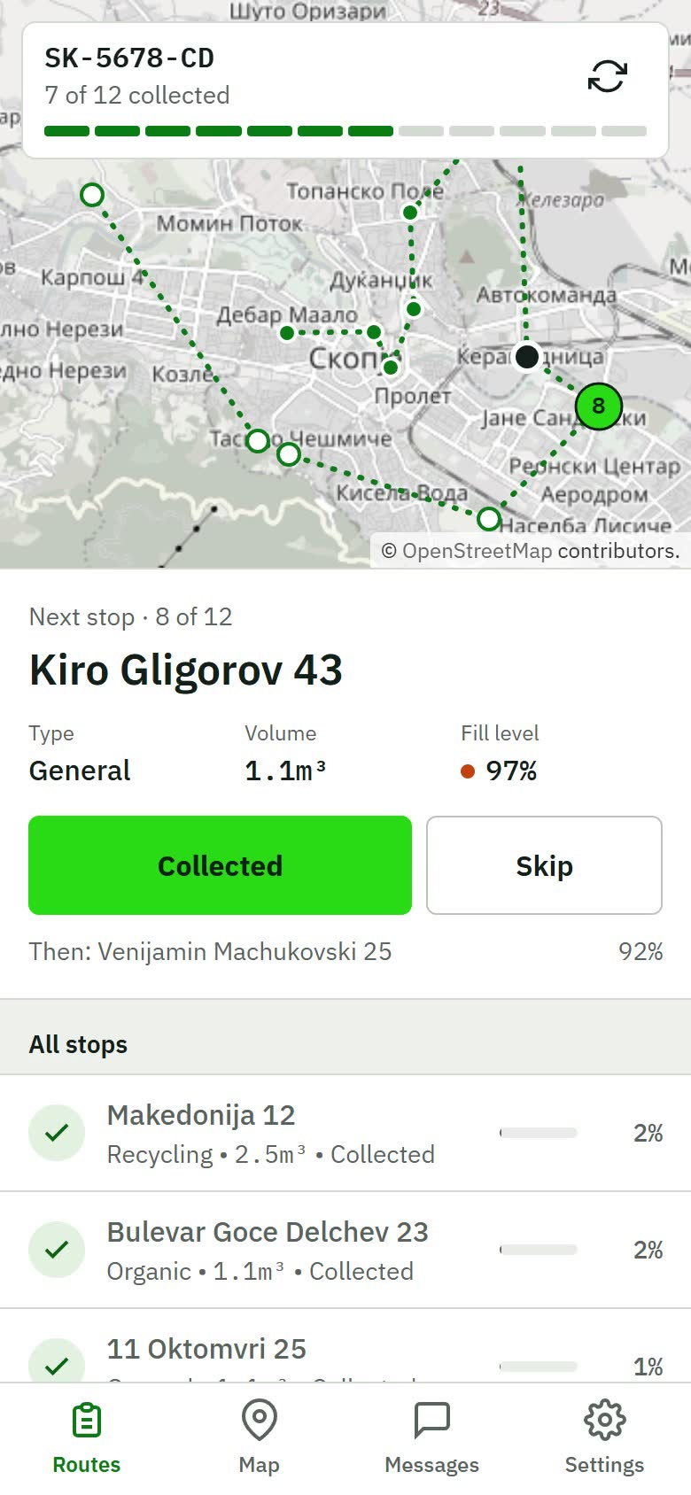
The driver app installs straight from the browser. It shows today's route and the next stop, and the rest of the day is one tap at a time.

  • One tap per stop. Collected or skipped, with the time and the driver recorded.
  • Keeps working without signal. A loaded route carries on, and everything syncs when the connection comes back.
  • In touch with dispatch. Two-way messages, and an emergency alert when it matters.
The driver app showing the next stop, with Collected and Skip buttons

The platform

What else your team gets.

Maps in 2D and 3D
See bins, trucks and routes on a large map, updated about every 30 seconds.
Your choice of tracking
Teltonika GPS trackers or the driver's phone, set truck by truck.
Geofences
Circular zones for depots, collection zones, restricted areas, customer sites and landfills.
Messaging
A conversation for each truck, and a broadcast to the whole fleet.
Reports
Collection, bin, truck and driver reports, ready to export to CSV.
Your data, kept apart
Each organisation's data sits in its own separate database.

See it working in your own city.

Tell us about your fleet and your bins, and we'll show you what NexusOptimo looks like with them.